Data Import
Import existing asset registers, reference layers, and spatial data from any source
Most field teams don't start from scratch—you have existing asset registers, GIS layers, spreadsheets, and historical data that need to flow into your inspection workflow. Geocadra imports data from GeoJSON, Shapefiles, KML, CSV, and Excel files, automatically matching coordinate systems and mapping attributes. Import your existing assets as inspection targets, bring in reference layers for context, or migrate historical records from legacy systems. No manual re-digitising, no coordinate conversion headaches, no starting over.
The Challenge with Legacy Data and Existing Systems
You've spent years building asset registers, digitising infrastructure, and collecting spatial data. Switching to a new field tool shouldn't mean abandoning that investment. Yet most field data tools expect you to start fresh—manually recreating asset locations, re-entering attribute data, and losing the historical context you've built. The alternative is maintaining parallel systems that never quite sync, with field crews toggling between old and new tools while data quality suffers.
How Geocadra Solves This
Geocadra treats import as a first-class feature. Drag and drop GIS files directly into projects—Shapefiles, GeoJSON, KML, GeoPackage, CSV with coordinates, or Excel with location data. The import wizard automatically detects coordinate systems, maps attribute columns to form fields, and handles projection transformations. Your existing asset IDs, classification codes, and attribute data come through intact. Import once, then tap on any imported feature in the field to start an inspection against that asset.
All major GIS formats supported
Existing asset IDs and attributes preserved
Automatic coordinate system detection
Visual attribute-to-field mapping
Data validation before import
Import as inspection targets or reference layers
How It Works
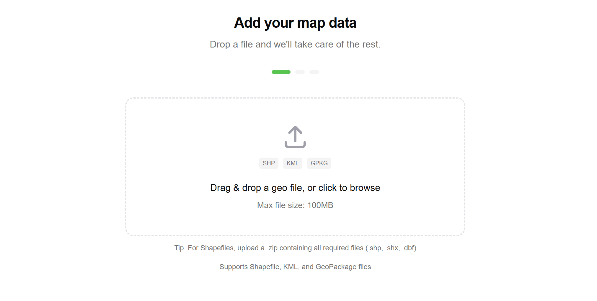
Upload Your Data
Drag and drop files into the import interface—Shapefiles (with all component files), GeoJSON, KML, GeoPackage, or CSV/Excel with coordinate columns. Multiple files can be uploaded at once for batch import.
Review Detection
Geocadra automatically detects the file format, coordinate reference system, and available attributes. Review the detection results and adjust if needed—for instance, specifying which columns contain X/Y coordinates in a CSV file.
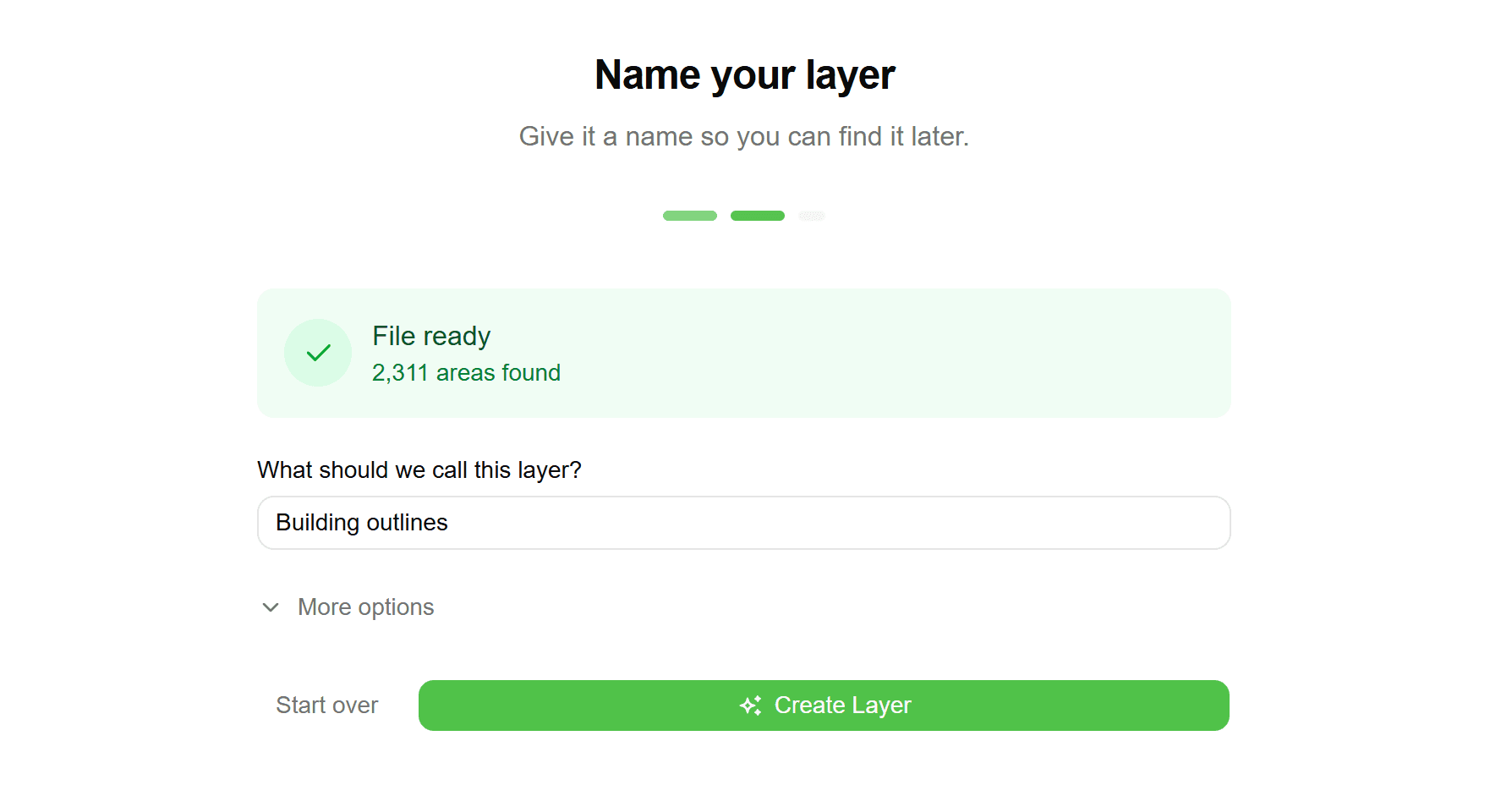
Map Attributes
Visual interface maps source columns to destination fields in your project. Match asset IDs, classifications, dates, and other attributes to the appropriate form fields. Save mapping configurations for reuse with similar data sources.
Validate Data
Preview the import and review any validation warnings—invalid geometries, missing required fields, coordinate outliers, or duplicate IDs. Fix issues in the source data or choose to import anyway with warnings.
Import and Use
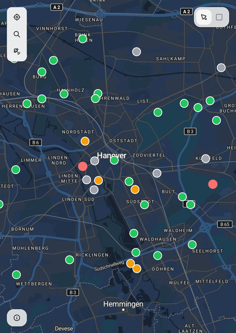
Complete the import and see your data appear on the map immediately. Features are now available as inspection targets—tap any imported asset in the mobile app to open an inspection form pre-populated with imported attributes.
Common Use Cases
Legacy System Migration
Moving from paper records, spreadsheets, or an old GIS system? Import your existing asset database and continue building inspection history without losing years of accumulated data.
Client-Provided Data
Clients often provide asset data in various formats—Shapefiles from their GIS team, Excel exports from their asset management system, or KML from Google Earth. Import directly without format conversion.
Reference Layers
Import parcels, boundaries, utility corridors, or other reference data to provide context during field work. Reference layers display on the map but don't require inspection forms.
Historical Records
Import previous inspection records from other systems to maintain continuity. See past inspection results alongside new data collection to track asset condition over time.
Frequently Asked Questions
What file formats can I import?
Geocadra imports Shapefiles (.shp with associated files), GeoJSON, KML/KMZ, GeoPackage (.gpkg), CSV with coordinate columns, and Excel (.xlsx) with location data. Files can be compressed in ZIP format.
How are coordinate systems handled?
Geocadra automatically detects common coordinate reference systems from file metadata. For ambiguous files, you can manually specify the CRS. All imported data is transformed to WGS84 for internal storage and display.
What happens if I import duplicate records?
The import wizard flags potential duplicates based on geometry proximity or matching ID fields. You can choose to skip duplicates, update existing records, or create new records regardless. Each approach suits different migration scenarios.
Are there limits on import file size?
Standard plans support imports up to 100MB per file. Enterprise plans have higher limits and can handle large-scale imports with millions of features. Very large imports are processed asynchronously with progress notifications.
Can I import data without geometry?
Yes, you can import tabular data (CSV/Excel) and join it to existing features by matching ID fields. This is useful for updating attributes on already-imported assets without affecting their geometry.
Explore More Features
See everything on the map
Points, lines, polygons—all your client's assets visualized instantly. No more imagining where things are from spreadsheet coordinates.
Built for multi-client work
Switch between clients instantly. Keep projects, forms, and data completely separate. Deliver to each client in their preferred format.
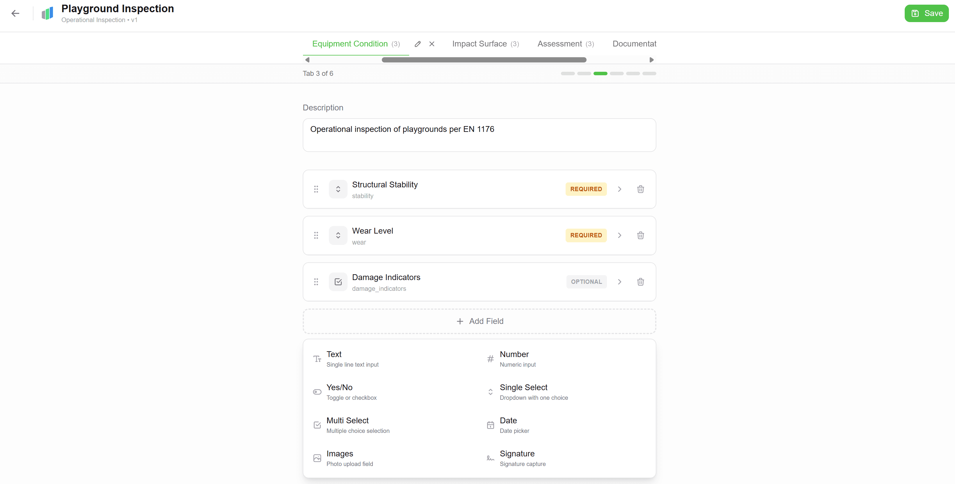
Forms that match your workflow
Drag-and-drop form builder. Text, numbers, dropdowns, photos—create exactly what your inspections need. Use across all projects.