Photo Documentation
Geotagged, timestamped photos automatically linked to inspection features
Photo evidence is essential for field inspections, but managing thousands of disconnected images is a nightmare. Geocadra automatically links every photo to the map feature and form record it documents, while embedding GPS coordinates and timestamps directly in the image metadata. No more folders of unnamed photos, no more guessing which image goes with which inspection, and no more manual matching in spreadsheets.
The Challenge with Traditional Photo Documentation
Most field teams take photos with their phone's camera app, separate from their inspection data. At the end of the day, they face hundreds of images with generic filenames like IMG_4521.jpg. Matching these photos to inspection records requires scrolling through timestamps, comparing backgrounds, and making educated guesses. Many photos can't be definitively linked to specific assets, making them useless for documentation or legal purposes. Even when photos include GPS tags, coordinates alone don't tell you which asset the photo depicts—was it the pole, the transformer, or the vegetation nearby?
How Geocadra Solves This
With Geocadra, photos are taken directly within the inspection workflow. When you tap the photo field in your form, the camera opens and your image is automatically linked to the current feature and form record. GPS coordinates and timestamps are embedded in the image EXIF data. Photos appear alongside their related data in exports, reports, and the web dashboard. The link is permanent and unambiguous—you'll never wonder which asset a photo depicts.
Every photo permanently linked to its feature
GPS coordinates embedded in image metadata
Date, time, and timezone recorded automatically
No more matching photos to inspections manually
Photo requirements ensure complete documentation
Cloud storage with unlimited photos included

How It Works
Photo Fields in Forms
When designing your inspection form, add photo fields where visual documentation is needed. You can specify minimum photo counts (e.g., 'at least 2 photos required'), add guidance text ('photograph the nameplate'), and set photos as required or optional.
Capture During Inspection
During field work, when you reach a photo field, tap to open the camera. Take your photos—they're immediately linked to the current feature and form record. You can see thumbnails of captured photos in the form, add more, or retake if needed.
Automatic Metadata
Every photo is automatically tagged with GPS coordinates from your device, the capture timestamp, the feature ID it's linked to, and the field worker's user ID. This metadata is embedded in the image EXIF data and stored in the database.
Review and Annotate
View captured photos in the app, on the web dashboard, or in exports. Photos appear in context alongside the inspection data they document. Add annotations or notes if additional context is needed.
Export with Data
When you export inspection data, photos come along automatically. Export options include linked folders, embedded images in PDF reports, or photo URLs in data exports. The link between photo and inspection record is never lost.
Common Use Cases
Defect Documentation
Photograph damage, wear, corrosion, or other defects with photos permanently linked to the affected asset. Evidence photos are timestamped and geotagged for use in reports, insurance claims, or regulatory filings.
Before/After Comparisons
Document asset condition before and after maintenance work. Separate photo fields for 'before' and 'after' states ensure complete documentation of work performed and condition improvements.
Compliance Evidence
Regulatory inspections often require photographic evidence. Required photo fields ensure inspectors can't submit without capturing the necessary documentation. Embedded timestamps prove when inspections occurred.
Nameplate and Serial Capture
Photograph equipment nameplates, serial numbers, and specifications. Photos linked to asset records provide visual confirmation of transcribed data and a fallback when text fields are ambiguous.
Frequently Asked Questions
Is there a limit on photo storage?
Photo storage is included in your plan with generous allowances for typical inspection workflows. Enterprise plans include unlimited storage. Photos are stored in their original resolution with no compression, ensuring quality is preserved for documentation purposes.
Can I attach photos from my camera roll?
Yes, in addition to taking new photos, you can select existing images from your device's photo library. However, photos taken within Geocadra have richer metadata including the exact feature linkage, which photos from your camera roll may lack.
How are photos included in exports?
You can export photos as linked files in folders, embedded in PDF reports, as URLs in CSV/Excel exports, or as attachments in GIS formats that support them. Export settings let you choose resolution and format based on your needs.
What metadata is captured with each photo?
Each photo includes GPS coordinates, capture timestamp (with timezone), device information, user ID, feature ID, project ID, and the form field it was captured in. This metadata is embedded in EXIF data and stored in the database for full traceability.
Explore More Features
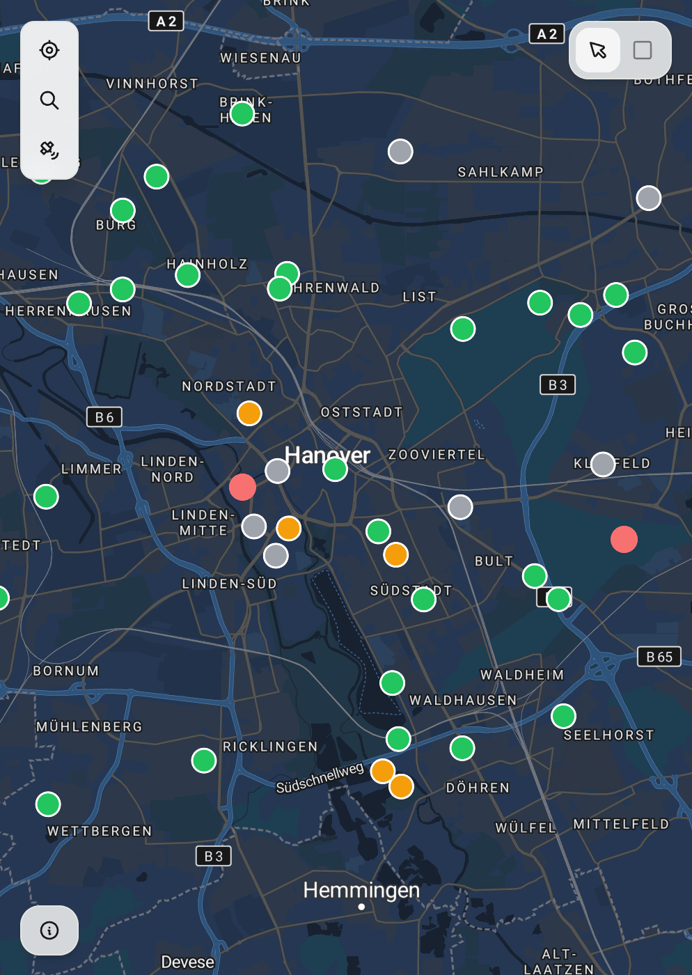
See everything on the map
Points, lines, polygons—all your client's assets visualized instantly. No more imagining where things are from spreadsheet coordinates.
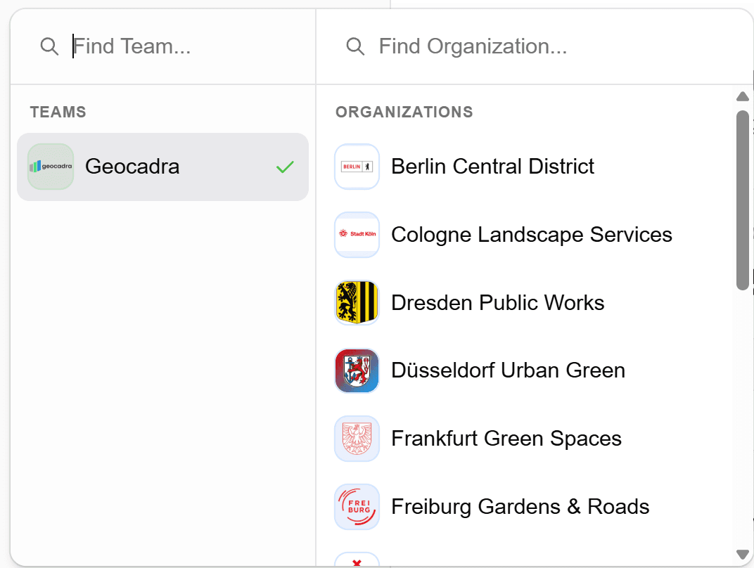
Built for multi-client work
Switch between clients instantly. Keep projects, forms, and data completely separate. Deliver to each client in their preferred format.
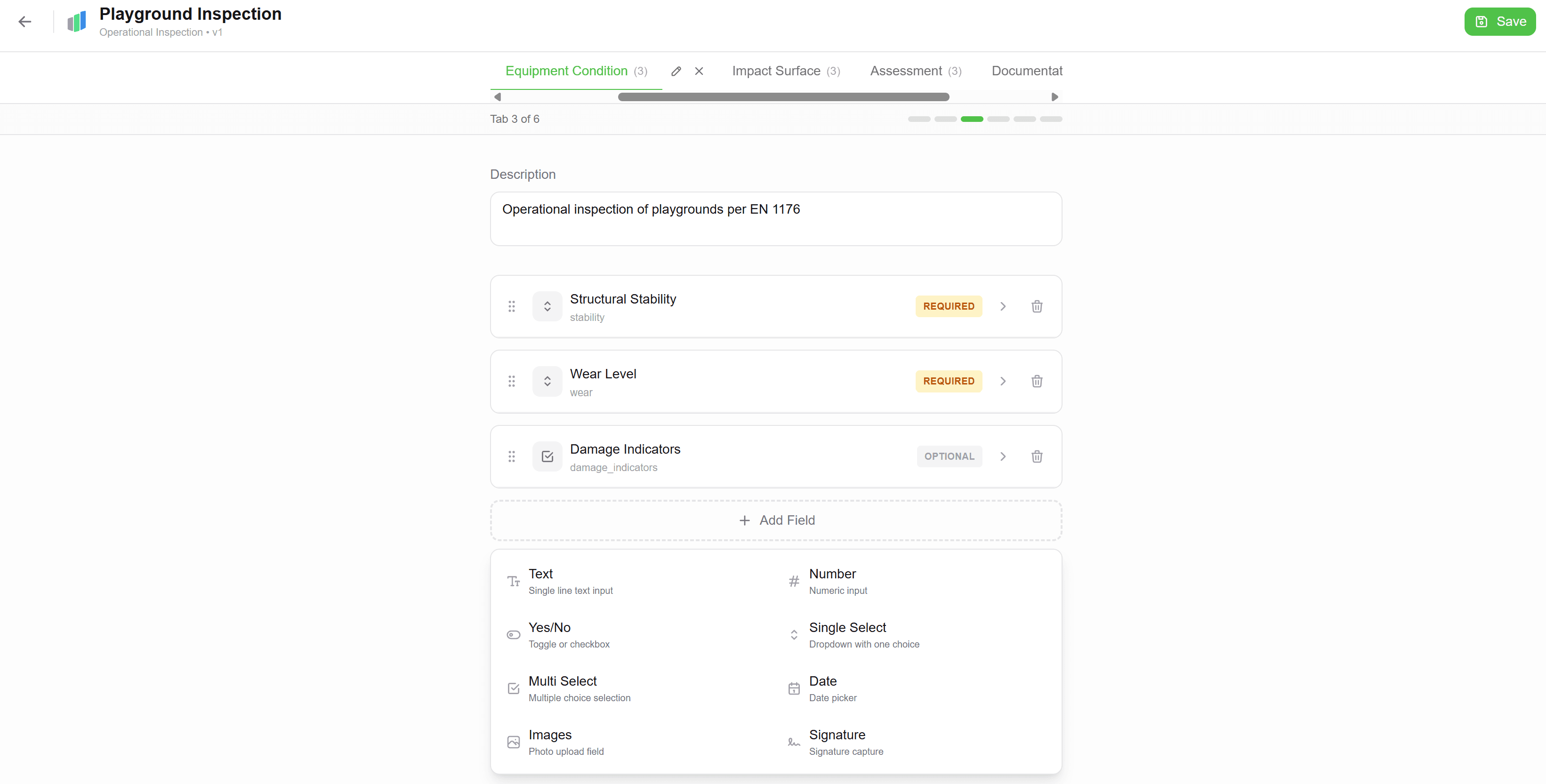
Forms that match your workflow
Drag-and-drop form builder. Text, numbers, dropdowns, photos—create exactly what your inspections need. Use across all projects.