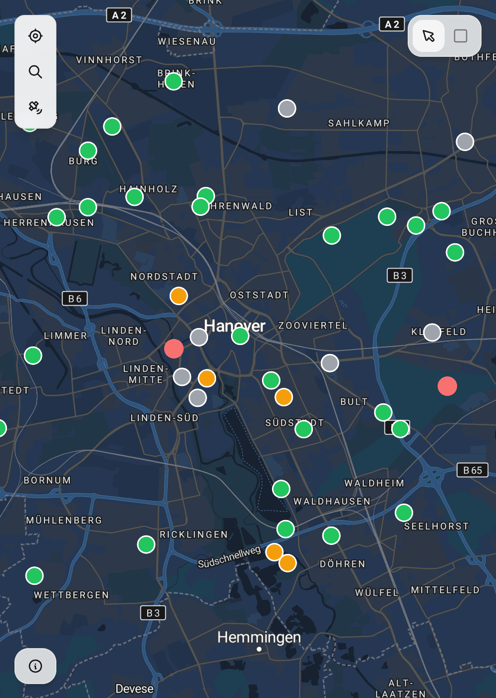
Map-Based Data Capture
Collect points, lines, and polygons with GPS accuracy on interactive maps
Stop switching between GPS apps and spreadsheets. Geocadra lets you capture spatial data directly on a map with centimeter-level accuracy. Whether you're documenting utility poles, mapping tree locations, or surveying property boundaries, our map-first approach ensures every piece of data is precisely georeferenced from the moment you collect it.
The Challenge with Traditional Field Data Collection
Field teams waste hours transferring coordinates between GPS devices, paper notes, and office software. A typical workflow involves reading coordinates from a handheld GPS, writing them on paper, later transcribing them into Excel, and finally importing them into GIS software. At each step, data gets lost, coordinates get transposed, and accuracy suffers. Studies show that manual coordinate entry has an error rate of 2-5%, meaning one in every 20-50 data points contains mistakes that can lead to costly field revisits or incorrect asset locations in your database.
How Geocadra Solves This
Tap to drop points, trace lines along features, or draw polygons around areas—all on an interactive map with satellite or street basemaps. Your data is instantly georeferenced using your device's GPS combined with visual map placement for maximum accuracy. There's no transcription step, no coordinate conversion, and no room for manual entry errors. Data flows directly from the field to your export file or connected systems.
GPS + visual placement for maximum accuracy
Capture data 3x faster than traditional methods
See your work on the map in real-time
Forms attach directly to map features
Choose from satellite, street, or custom basemaps
Support for points, lines, and polygon geometries
How It Works
Open the Map View
Launch Geocadra and navigate to your project. The map automatically centers on your current GPS location with your chosen basemap—satellite imagery for rural areas, street maps for urban environments, or custom layers provided by your organisation.
Select Your Geometry Type
Choose whether you're capturing a point (single location like a pole or tree), a line (linear features like cables, pipes, or paths), or a polygon (areas like parcels, zones, or building footprints). Each geometry type has optimised controls for fast, accurate capture.
Capture Your Data
For points, simply tap the map or use your current GPS location. For lines, trace along the feature by adding vertices. For polygons, draw the boundary and close the shape. GPS coordinates are recorded automatically with each tap, and you can see accuracy indicators in real-time.
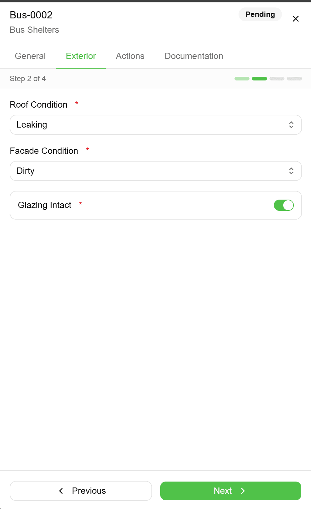
Complete the Linked Form
Once your geometry is captured, the associated inspection form opens automatically. Fill in the attribute data—condition assessments, measurements, photos, and any custom fields your organisation requires. All data is permanently linked to the geometry you just captured.
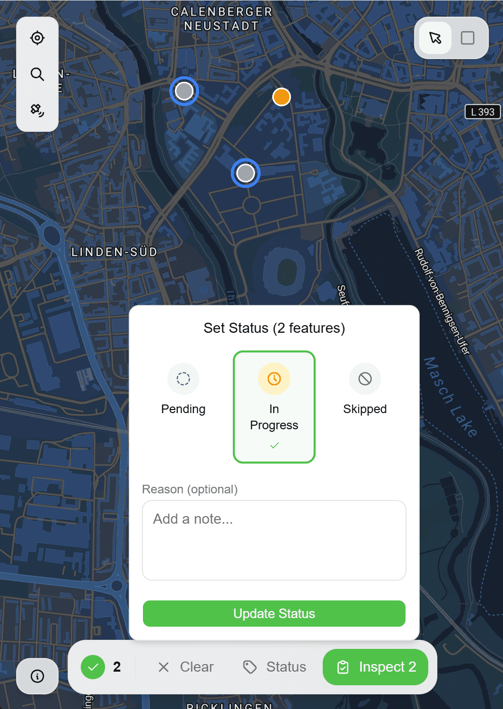
Review and Submit
See your captured feature on the map with its completed form data. Make any adjustments if needed, then save. Your data syncs to the cloud and becomes immediately available for export or integration with your GIS systems.
Common Use Cases
Utility Pole Inspections
Utility companies use map-based capture to document pole locations, attach condition assessment forms, and photograph defects—all georeferenced to the exact pole position. This eliminates the common problem of photos that can't be matched to specific poles later.
Environmental Surveys
Ecologists and environmental consultants capture species locations, habitat boundaries, and sample points directly on the map. Polygon tools are especially useful for mapping vegetation communities or wetland extents.
Construction Site Documentation
Site managers document as-built locations, mark underground utility strikes, and record progress across large construction projects. Line tools capture cable routes and pipe runs with multiple vertices for accurate representation.
Property Inspections
Building inspectors and property surveyors capture point locations for defects, draw polygons around affected areas, and attach detailed inspection forms—all while maintaining a clear visual record of what was inspected where.
Frequently Asked Questions
How accurate is the GPS positioning?
Accuracy depends on your device's GPS hardware and conditions. Most modern smartphones achieve 3-5 metre accuracy outdoors. For sub-metre accuracy, Geocadra supports external Bluetooth GPS receivers. You can also manually adjust point positions on the map for precise placement against visible features in the satellite imagery.
What basemap options are available?
Geocadra includes OpenStreetMap and satellite imagery by default. Enterprise customers can add custom basemaps including WMS/WMTS services, your organisation's GIS layers, or high-resolution aerial photography.
Can I import existing spatial data to work from?
Yes, you can import GeoJSON, Shapefiles, or KML files as reference layers. This is useful when you need to inspect existing assets—import your asset register and tap on features to open inspection forms, rather than re-capturing geometries.
What coordinate systems are supported?
Data is captured in WGS84 (EPSG:4326) and can be exported in various projections including UTM zones, national grid systems, and custom coordinate reference systems. Specify your required output projection in export settings.
Explore More Features
Built for multi-client work
Switch between clients instantly. Keep projects, forms, and data completely separate. Deliver to each client in their preferred format.
Forms that match your workflow
Drag-and-drop form builder. Text, numbers, dropdowns, photos—create exactly what your inspections need. Use across all projects.
Speak every format
GeoJSON, Shapefile, DXF, CSV, KML—bring data from any source. Take over client datasets without conversion headaches.