Habitat surveys, EIA documentation, and biodiversity monitoring made reliable
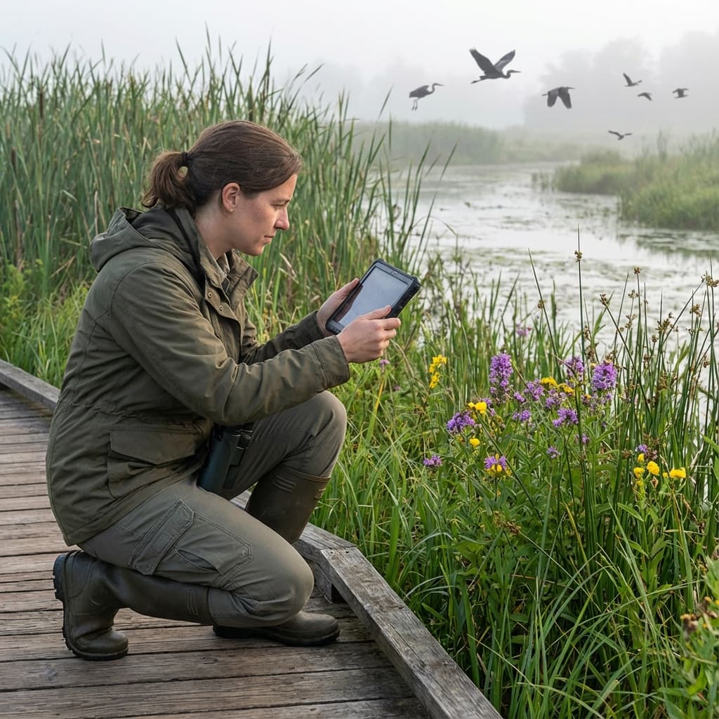
Environmental consultancies across Europe face a perfect storm of challenges: stricter regulations under the EU Habitats Directive, the UK's mandatory Biodiversity Net Gain requirements, and a shortage of 33,000 skilled ecologists. Your tools need to enable effective fieldwork by team members with varying experience levels while maintaining the data quality that regulatory submissions demand. Geocadra provides the reliable platform that ecological surveys require—whether you're documenting Phase 1 habitats in a remote peatland, conducting protected species assessments, or establishing BNG baselines across multiple development sites.
The Challenges Environmental Consultants Face Daily
Ecological fieldwork happens in challenging conditions with strict regulatory requirements. Generic data collection tools don't address the specific needs of environmental professionals.
The Skilled Ecologist Shortage
With 33,000 fewer qualified ecologists than the industry needs, consultancies must deploy team members with varying experience levels. Graduate ecologists, assistant surveyors, and cross-trained staff need tools that guide them through standardised survey methodologies without requiring years of field experience. Yet most digital tools assume expert knowledge, leaving less experienced team members struggling with classification decisions and documentation requirements.
Increasingly Complex Regulatory Requirements
The EU Habitats Directive protects 1,389 species across 23,500+ Natura 2000 sites, each with specific monitoring protocols. The UK's Biodiversity Net Gain mandate requires detailed baseline assessments using the DEFRA metric. Environmental Impact Assessments demand systematic documentation that can withstand legal scrutiny. Paper-based systems struggle to meet these requirements consistently, and data discrepancies of 7% or more are common when field notes are transcribed back in the office.
Surveys in Areas Without Mobile Coverage
Ecological surveys by definition happen where nature is—remote wetlands, ancient woodlands, upland peatlands, and protected sites far from mobile infrastructure. Cloud-dependent apps fail precisely where ecological data matters most. Teams resort to paper backup systems, creating data reconciliation problems and risking incomplete records when the most interesting findings occur in the most remote locations.
Photo Evidence Is Critical but Poorly Managed
Species identification often requires expert review of field photographs. Habitat boundary decisions need visual documentation. Regulatory submissions demand geotagged photo evidence. Yet matching hundreds of camera photos to specific survey points—often taken weeks or months earlier—consumes hours of senior ecologist time. Metadata gets lost, photos get misfiled, and critical evidence becomes impossible to locate when needed.
Tight Seasonal Survey Windows
Many ecological surveys can only occur during specific seasons—breeding bird surveys in spring, great crested newt assessments in particular months, botanical surveys when plants are flowering. These narrow windows create intense pressure to maximise productive field time. Any inefficiency in data collection—struggling with apps, waiting for connectivity, re-surveying due to data loss—directly impacts project delivery and client relationships.
There's a better way. →
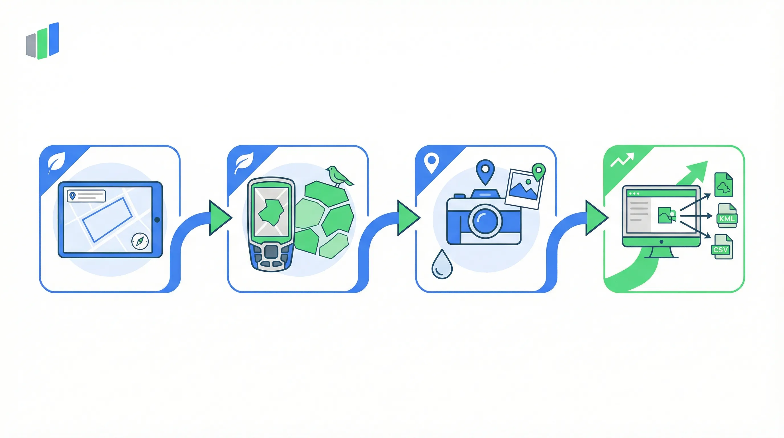
How Geocadra Supports Environmental Fieldwork
Every Geocadra feature was designed to address real challenges that ecological survey teams face in the field.
Intuitive Interface That Enables Less Experienced Staff
Geocadra's form builder lets you create survey templates with built-in guidance—dropdown menus for habitat classifications, reference photos for identification, conditional logic that shows relevant fields based on previous answers. Graduate ecologists and assistant surveyors can follow standardised methodologies without constant supervision, while senior staff review and validate data efficiently.
Templates Matching Regulatory Survey Requirements
Pre-built form templates for Phase 1 habitat surveys, BNG baseline assessments, and protected species surveys ensure your team captures all required data. Custom fields let you add client-specific requirements without starting from scratch. The result is consistent, complete documentation that meets regulatory standards every time.
Photos Automatically Linked to Survey Points
Every photo taken within Geocadra automatically attaches to the current survey record with GPS coordinates and timestamp. No more matching camera photos to field notes weeks later. Species identification photos, habitat boundary evidence, and site context shots all stay organised and findable. Export photo reports with all metadata intact for regulatory submissions.
Maximise Productive Survey Time
Fast data entry means more survey points per field day. Duplicate recent records when surveying similar habitats. Use voice notes for detailed observations. Automatic GPS capture eliminates manual coordinate recording. Teams consistently report completing 50-60% more survey work in the same field time after switching to Geocadra.
Common Workflows
Here's exactly how ecological survey teams use Geocadra in the field—from survey planning through to client-ready report delivery, step by step.
Phase 1 Habitat Surveys
Map habitat boundaries as polygons with standardised JNCC classifications, target notes, and species lists—producing GIS-ready data for ecological reporting.
- Load the site boundary onto Geocadra's map and open the Phase 1 habitat survey template. Previous survey data and aerial imagery provide context before you start walking the site.
- Draw habitat polygons directly on the map by tapping boundary points as you walk. Select the JNCC habitat code from the dropdown list—the form auto-populates relevant fields for that habitat type.
- Record target notes at notable features: species lists, management indicators, invasive species presence, and habitat condition. Attach geotagged photos to each target note for evidence.
- Export the completed survey as GIS-ready shapefiles or GeoJSON with all attribute data, photos, and target notes attached. Import directly into QGIS or ArcGIS for report mapping.
Protected Species Assessments
Document protected species observations with precise locations, count data, habitat suitability scores, and supporting photo evidence for regulatory submissions.
- Open the protected species survey template for your target species (e.g., great crested newts, bats, badgers). The form includes species-specific fields based on standard assessment methodologies.
- Record each observation with a GPS point on the map: species identification, count, age/sex class, behaviour, and habitat context. Reference photos in the form help less experienced surveyors confirm identifications.
- Assess habitat suitability at each survey location using the standardised scoring criteria built into the template. The Habitat Suitability Index calculates automatically from your field inputs.
- Log survey effort data—start/end times, weather conditions, surveyor details, and methodology used. This audit trail is essential for regulatory submissions and demonstrates thorough assessment coverage.
Biodiversity Net Gain Baseline Surveys
Capture habitat parcels with condition assessments aligned to the DEFRA biodiversity metric, ready for BNG calculations and planning submissions.
- Import the red-line boundary from the planning application and open the BNG baseline template. Geocadra displays the site with aerial imagery so you can pre-identify likely habitat parcels before visiting.
- Walk the site boundary and internal habitat edges, drawing polygons for each distinct habitat parcel. Select the habitat type from the DEFRA metric classification list and record the area automatically.
- Complete the condition assessment for each parcel: score against the metric's condition criteria, record strategic significance, note connectivity with adjacent habitats, and capture supporting photographs.
- Export the complete baseline dataset structured for the DEFRA biodiversity metric spreadsheet. Habitat types, areas, condition scores, and strategic significance transfer directly into the metric calculator.
Wetland Delineation and Monitoring
Map wetland boundaries with hydrology observations, indicator species records, and soil characteristics—tracking changes across repeated monitoring visits.
- Load the study area and any previous wetland delineation data. Walk the wetland boundary with Geocadra recording your GPS track to define the delineation edge.
- At each sample point along the boundary, record the three-parameter approach: vegetation (dominant species list and wetland indicator status), soils (colour, texture, mottling, gleying), and hydrology (water table depth, surface water, saturation indicators).
- Capture photographs at each sample point showing vegetation community, soil profile, and hydrological conditions. Photos attach automatically to the sample point with full metadata.
- Compare current delineation with previous visits using Geocadra's historical overlay. Export change analysis data showing boundary shifts, condition trends, and monitoring recommendations for your client report.
Environmental Impact Assessment Fieldwork
Conduct systematic EIA site assessments with photo-documented survey points across multiple environmental disciplines, creating defensible audit trails.
- Create survey zones within the EIA study area and assign team members to specific zones. Each zone has its own set of survey forms covering relevant environmental topics (ecology, noise, air quality, landscape, water).
- Work through each zone systematically, dropping survey points on the map. At each point, complete the relevant disciplinary assessments—receptor identification, baseline conditions, potential impact pathways, and sensitivity ratings.
- Document existing environmental conditions with geotagged photos: views to and from the site for landscape assessment, receptor locations, watercourse conditions, existing vegetation, and noise-sensitive properties.
- Export the complete EIA fieldwork package: survey point maps, completed assessment forms, photo schedules with metadata, and surveyor effort logs. All data is timestamped and GPS-verified for audit defensibility.
Water Quality and Sampling
Record water sample locations with precise GPS coordinates, field parameters, sampling conditions, and complete chain of custody documentation for laboratory analysis.
- Navigate to each pre-defined sampling point using Geocadra's map. The sampling schedule shows which parameters to measure at each location and which sample bottles to use.
- Record field parameters directly in the form: pH, dissolved oxygen, conductivity, temperature, turbidity, and flow rate. The template validates readings against expected ranges and flags anomalies for immediate re-measurement.
- Document sampling conditions: weather, flow state, upstream activities, and any visible contamination. Photograph the sampling location, equipment setup, and sample bottles with legible labels.
- Complete the chain of custody record on-device: sample IDs, preservation methods, transport conditions, and handover signatures. Export the complete sampling record for laboratory submission and regulatory reporting.
Measurable Results
Compliance & Standards
Geocadra helps environmental consultancies meet the documentation requirements of key regulatory frameworks.
EU Habitats Directive
The EU Habitats Directive protects 1,389 species across Europe with specific survey and monitoring requirements. Geocadra's species-specific survey templates ensure your team captures all required data for protected species assessments, while geotagged photos provide the evidence regulatory submissions demand.
UK BNG
The UK's Biodiversity Net Gain mandate requires detailed baseline habitat assessments using the DEFRA biodiversity metric. Our BNG templates capture habitat parcels with condition scores, distinctiveness categories, and strategic significance factors—structured for direct metric calculation and submission.
Natura 2000
Over 23,500 Natura 2000 protected sites require standardised monitoring documentation across Europe. Geocadra's consistent data capture and GIS-ready exports streamline reporting to national authorities while maintaining the evidence standards these designations require.
Phase 1 Habitat Survey
The JNCC Phase 1 Habitat Survey methodology remains the industry standard for habitat classification in the UK. Our survey templates follow Phase 1 conventions including habitat codes, target note structures, and mapping standards—ensuring your survey data meets professional expectations.
Frequently Asked Questions
Do surveyors need GIS experience to use Geocadra?
No. The mobile interface is designed for ecological fieldwork, not GIS expertise. Surveyors draw habitat polygons by tapping on the map, much like drawing on a touchscreen. Forms guide data entry with dropdown menus and validation. GIS professionals can then work with exported data in QGIS, ArcGIS, or other platforms.
Does Geocadra support BNG metric calculations?
Geocadra captures all the field data needed for BNG calculations—habitat types, condition scores, distinctiveness categories, and strategic significance. You export this data to the DEFRA metric calculator or your preferred BNG software. We're also developing direct metric integration for future releases.
How accurate is the GPS for habitat boundary mapping?
Standard smartphone GPS provides 3-5 metre accuracy, which is sufficient for most Phase 1 habitat surveys. For higher precision requirements, Geocadra supports external Bluetooth GPS receivers that can achieve sub-metre or centimetre accuracy with RTK correction.
Can we submit species records to biological record centres?
Yes. Export data in formats compatible with iRecord, NBN Atlas, and local environmental records centres. All required fields—species, location, date, recorder, determination method—are captured during standard survey workflows.
How do survey teams collaborate on large projects?
Assign specific survey areas to individual team members through the dashboard. Everyone sees the same base data and can view each other's progress in real-time (when connected). Supervisors review and validate submitted records before client reporting.
Ready to transform your Environmental Consulting workflow?
Join teams who've already made the switch